Example Projects
We have completed over 400 unique projects since forming the company in 2014. Here are some of our top projects that were completed using UAV (drone) technology.
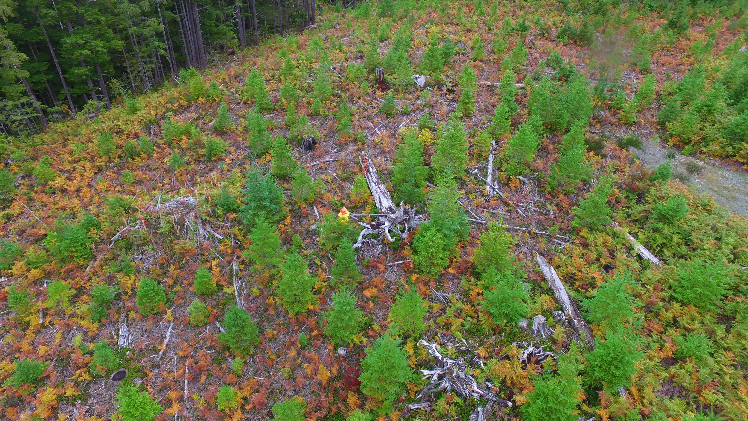
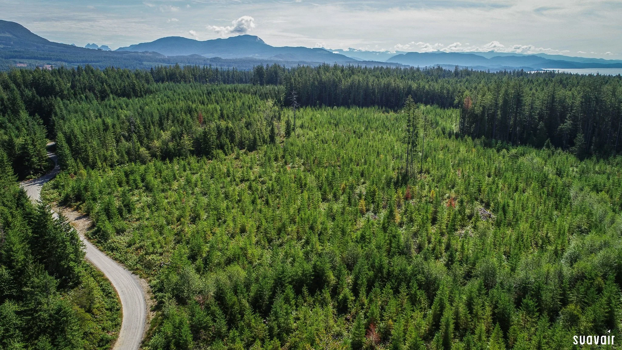
Silviculture Surveys – Western FP, Mosaic FP, Interfor, BCTS
SuavAir has been silviculture surveying since 2015. Since then we have grown to conducting over 20,000ha/yr of Regen, Free-to-grow and Brushing surveys. Our UAV survey process is safer and offers a lower cost than traditional ground survey techniques, although we still implement on the ground plots when required. As professional foresters, all reports are RPF signed and stamped.
“SuavAir’s reports have always been accurate with good attention to detail. The imagery has allowed us to make better forest management decisions.”
– Carolina Silva RPF, WFP Area Forester

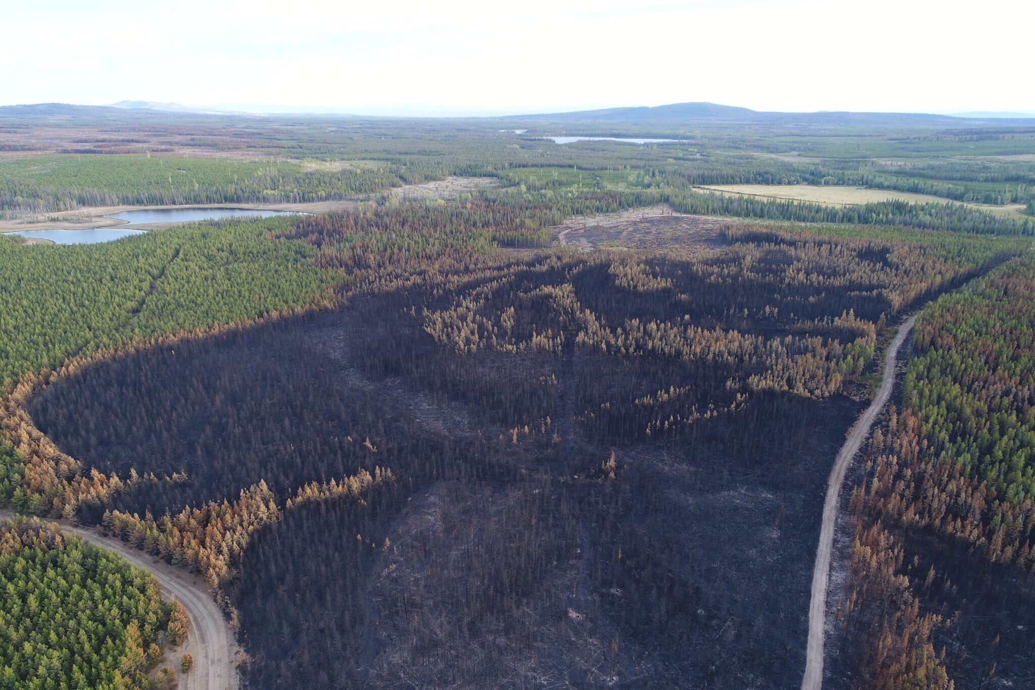
Hotspot Scanning and Mapping – BC Wildfire Service
Using infrared thermal cameras, we have the ability to detect hotspots from wildfires within 5 meters of their location. We have worked on over 70 unique fires since 2016 and have contributed to the wildfire fighting efforts by BCWS. Drones offer a cheaper, safer, and more accurate option than traditional methods for hotspot detection.
We also have the ability to map the burned area to create an orthomosaic image that can be used to determine fire perimeters and calculate the total area burned. This is useful for fire fighters to determine access to the site, as well as for future forest rehabilitation efforts.


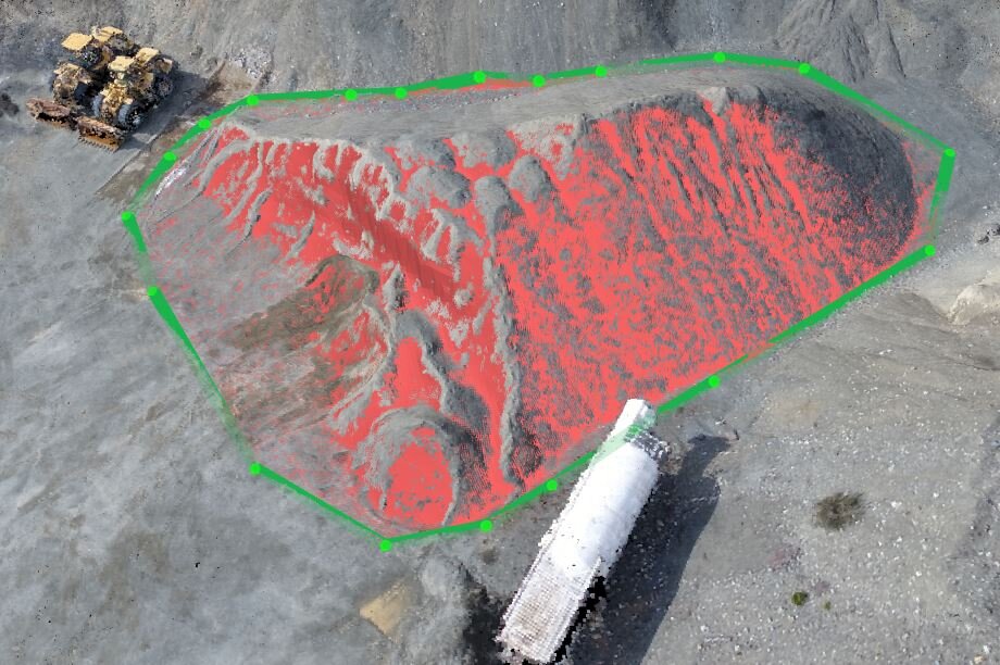
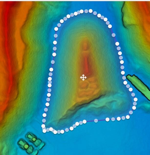
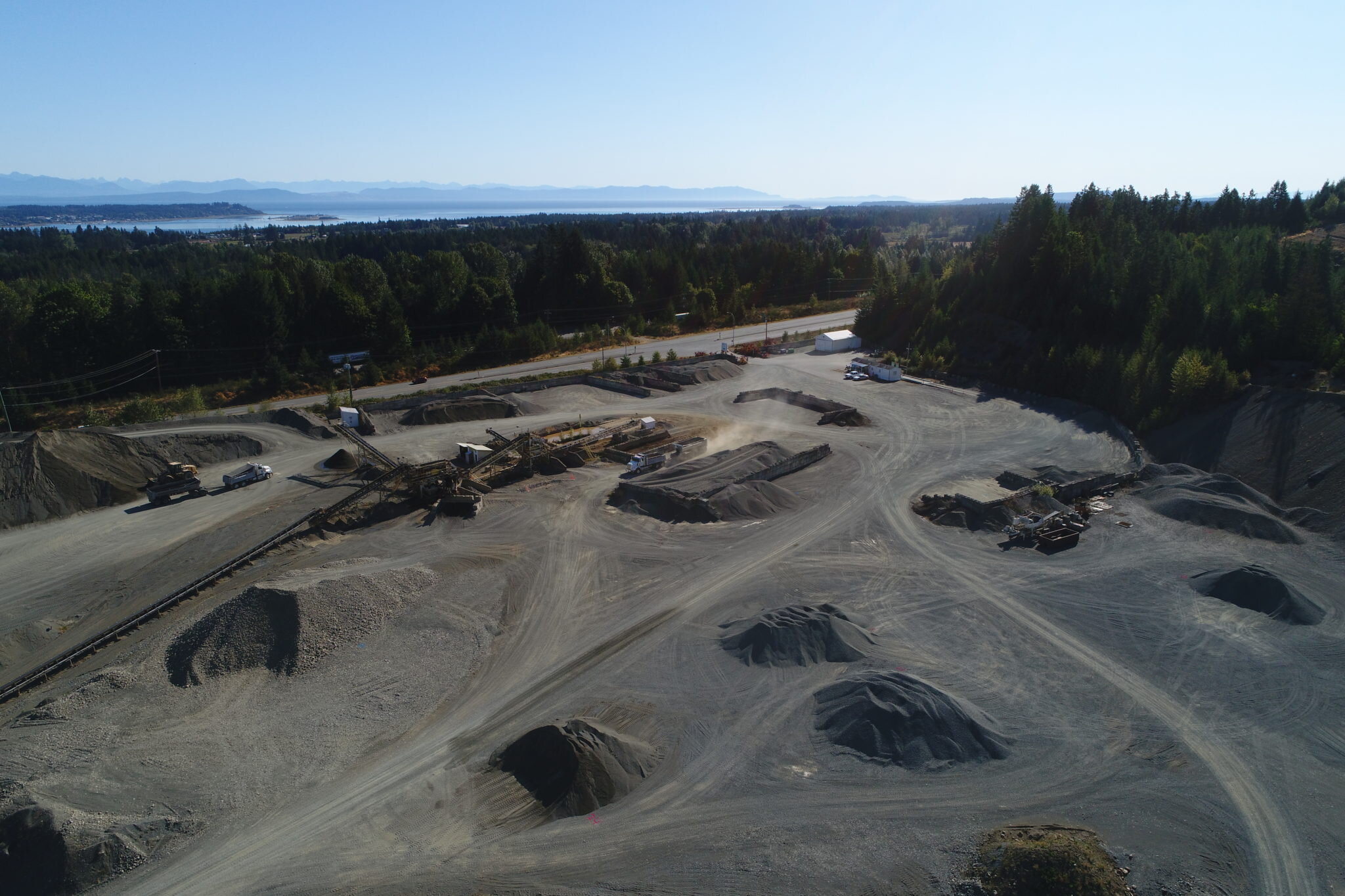
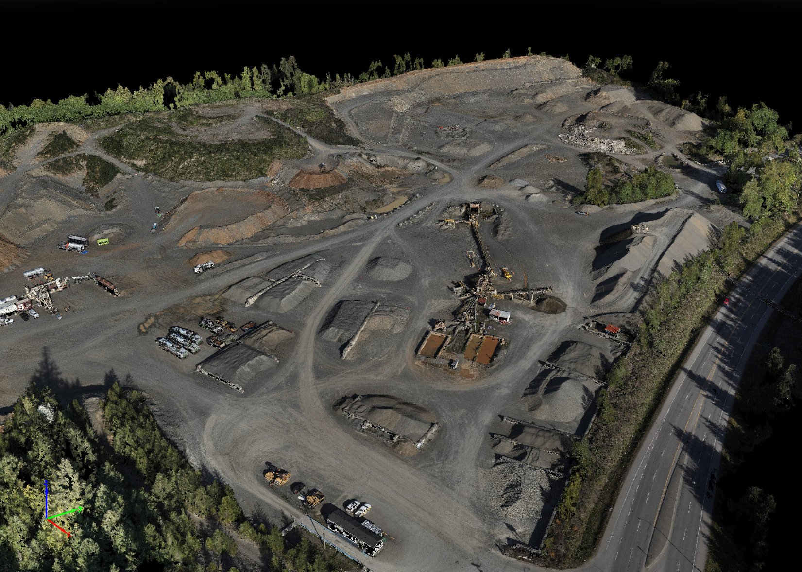
Volumetrics Surveys – Lafarge Canada
Creating point clouds and 3D models from our drone imagery and LiDAR Sensors allows us to complete volumetrics surveys for aggregates. Several times per year, we survey / measure all of Lafarge’s gravel pits on Vancouver Island to give them updated inventory information. The data is highly accurate, efficient to collect and much safer than traditional survey methods.
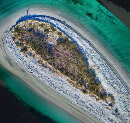
Invasive Species Mapping – Parks Canada
The Gulf Island National Park is home to several rare species of plants. Unfortunately, they have been encroached on by invasive plants. As part of Parks Canada’s mandate to remove the invasive species, we mapped the area in extremely high resolution (1cm) to help them in their environmental management strategy. Also acquired oblique angle imagery for their website and social media marketing.
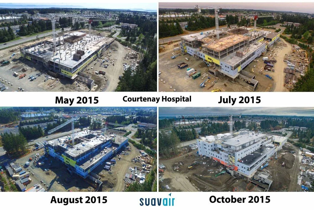
NI Hospitals Project – VI Health Authority
The North Island Hospital Project is constructing two new hospitals on Vancouver Island, one in Campbell River and one in Courtenay. SuavAir has provided imagery on scheduled intervals to provide a time lapse of the ongoing changes in construction. Imagery has been used for contractor planning, monitoring, and updates to the general public.
“SuavAir is a pleasure to work with. These guys are creative, innovative and responsive to the challenges of telling the story of our hospital construction project.”
– Dan Maclennan, Communications Officer
Oyster River – Strathcona Regional District
The Oyster River is subject to annual flooding, creating erosion and changing riverbank conditions. SuavAir was hired to create maps for the river during two seasons, fall of 2016 and winter of 2017 for change detection.
“The ability to capture imagery of undermined/unstable river bank edges and coastal erosion areas is an invaluable data collection technique. The unique perspective afforded by the UAV was previously unavailable. Comparisons of this data, over time, should prove enlightening and will provide invaluable insight into change detection and mitigation planning.”
– Douglas Sauer, GIS Analyst

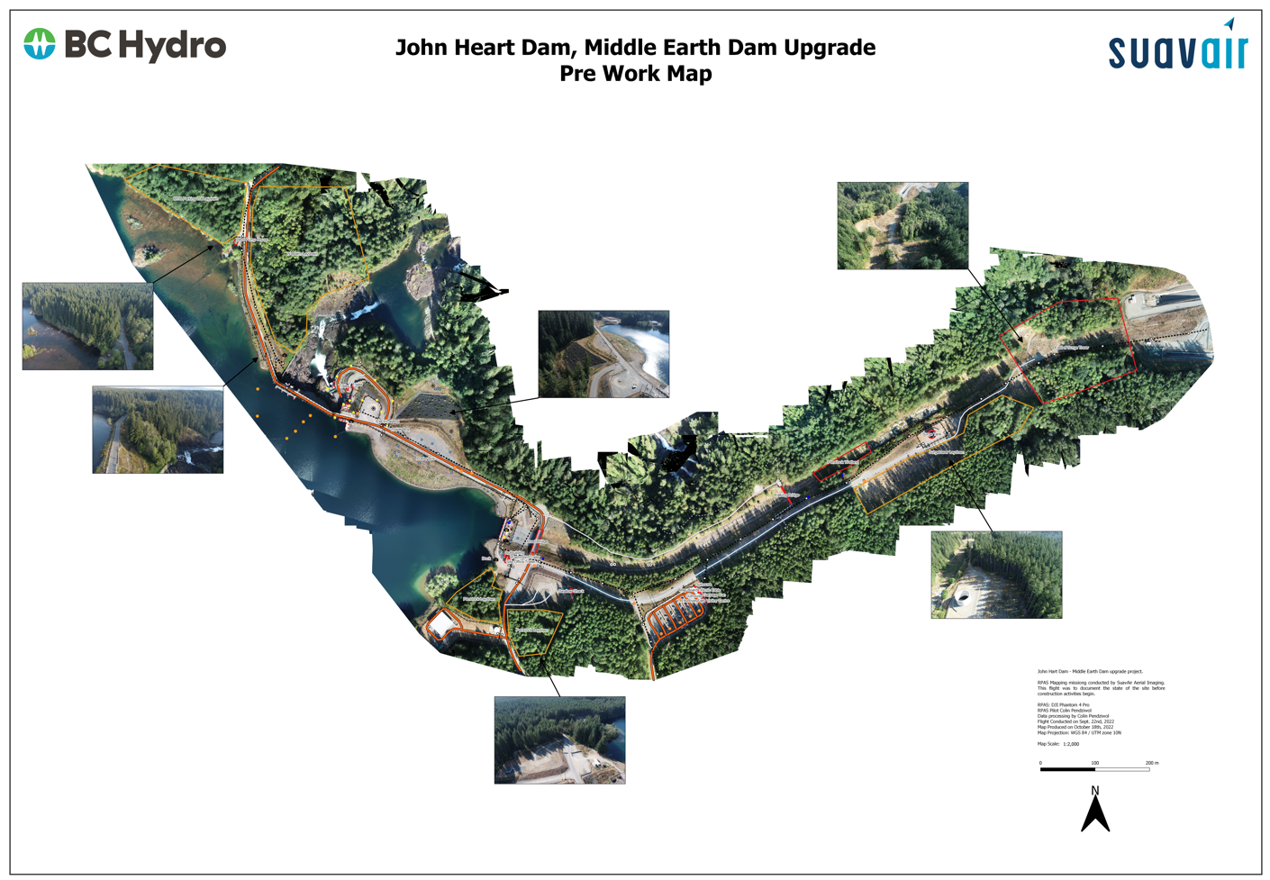
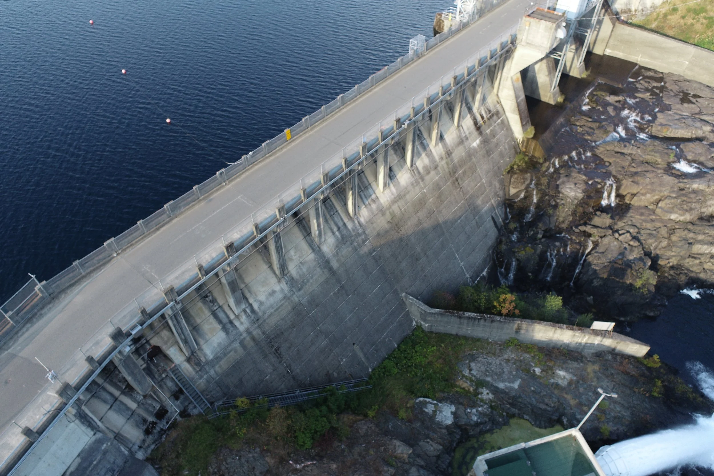
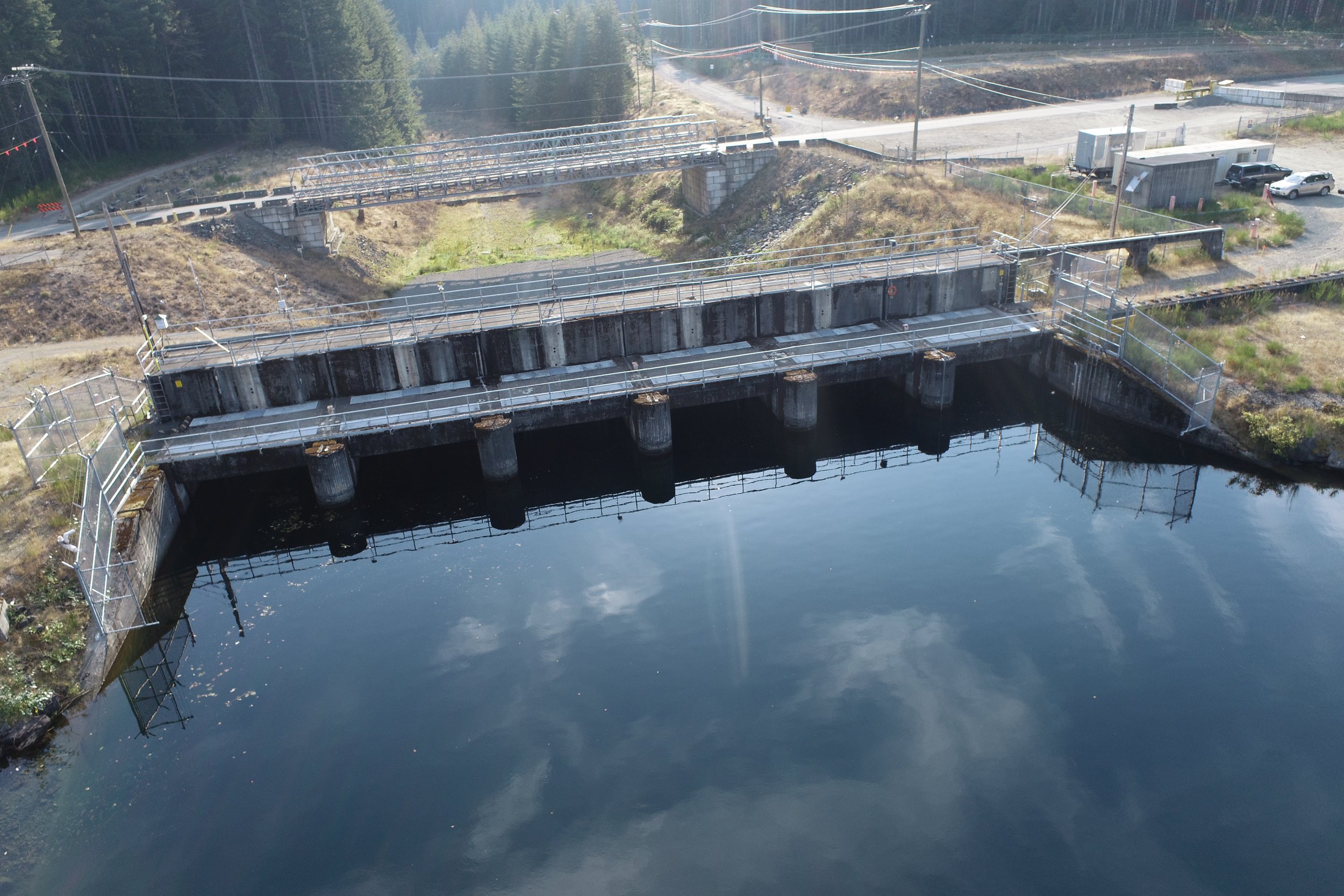
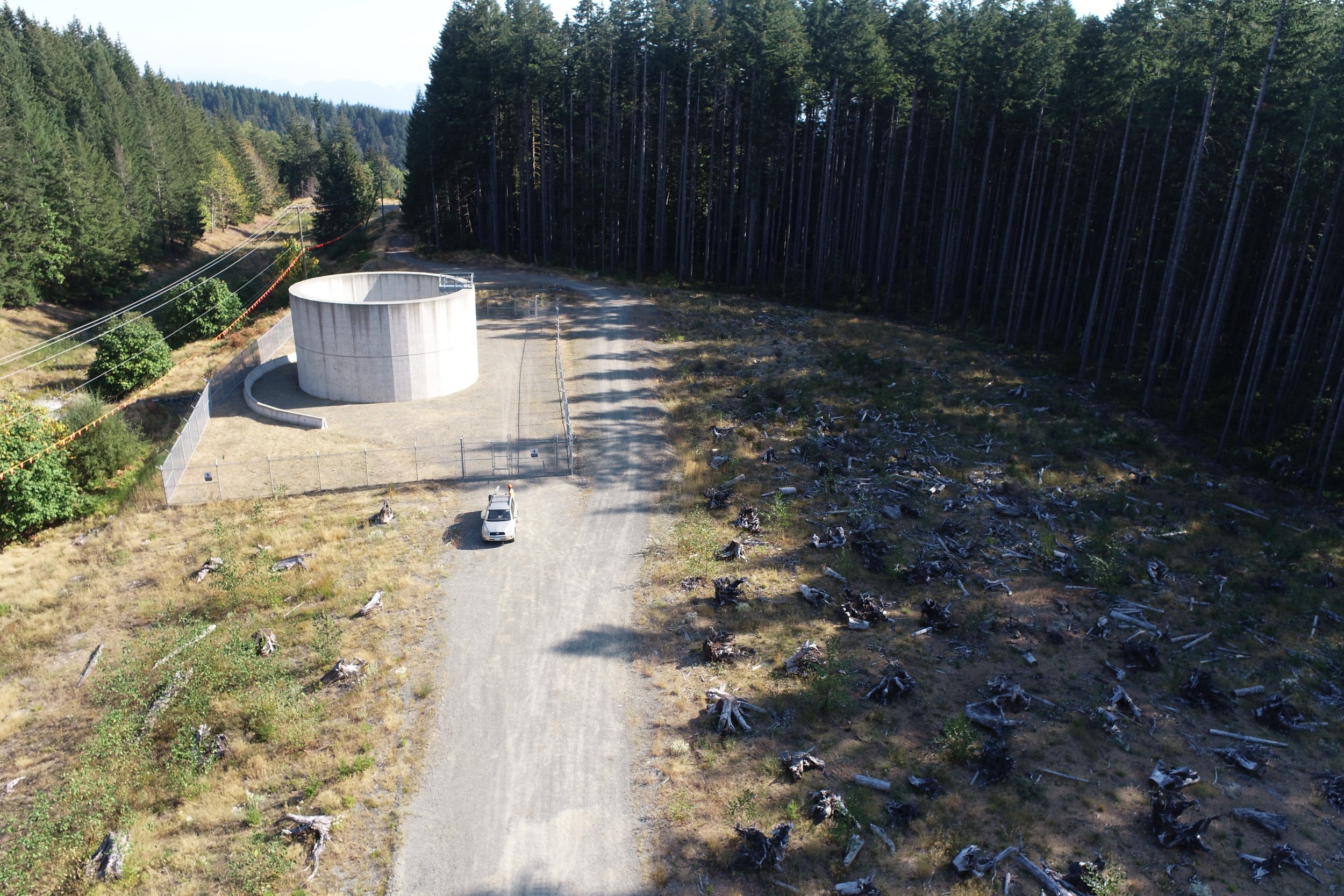
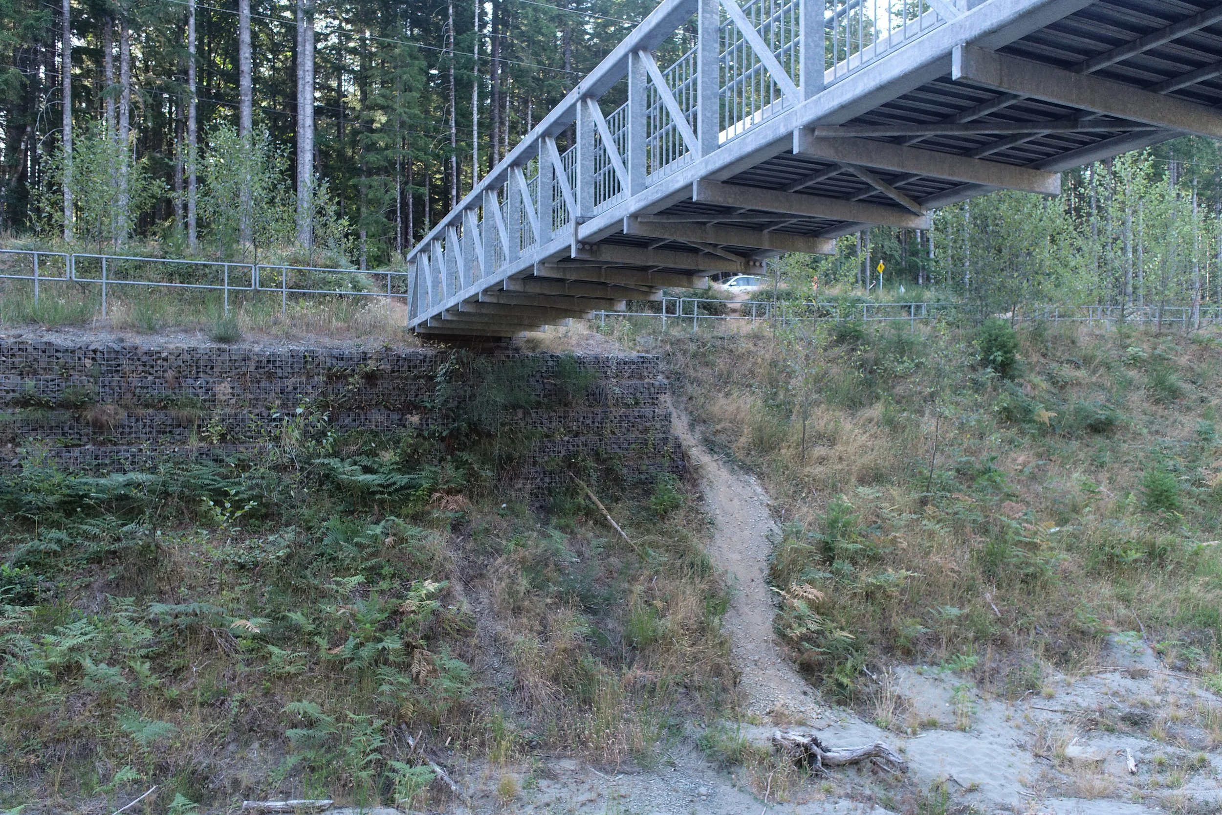
Condition Monitoring - BC Hydro John Hart Dam
The John Hart Dam in Campbell River is undergoing upgrades. SuavAir was hired to record the conditions of the site before work was started in order to be able to monitor the change over time. These recordings include a map and 3D model of the entire site, infrastructure identification as well as photo and videos of each point of interest.
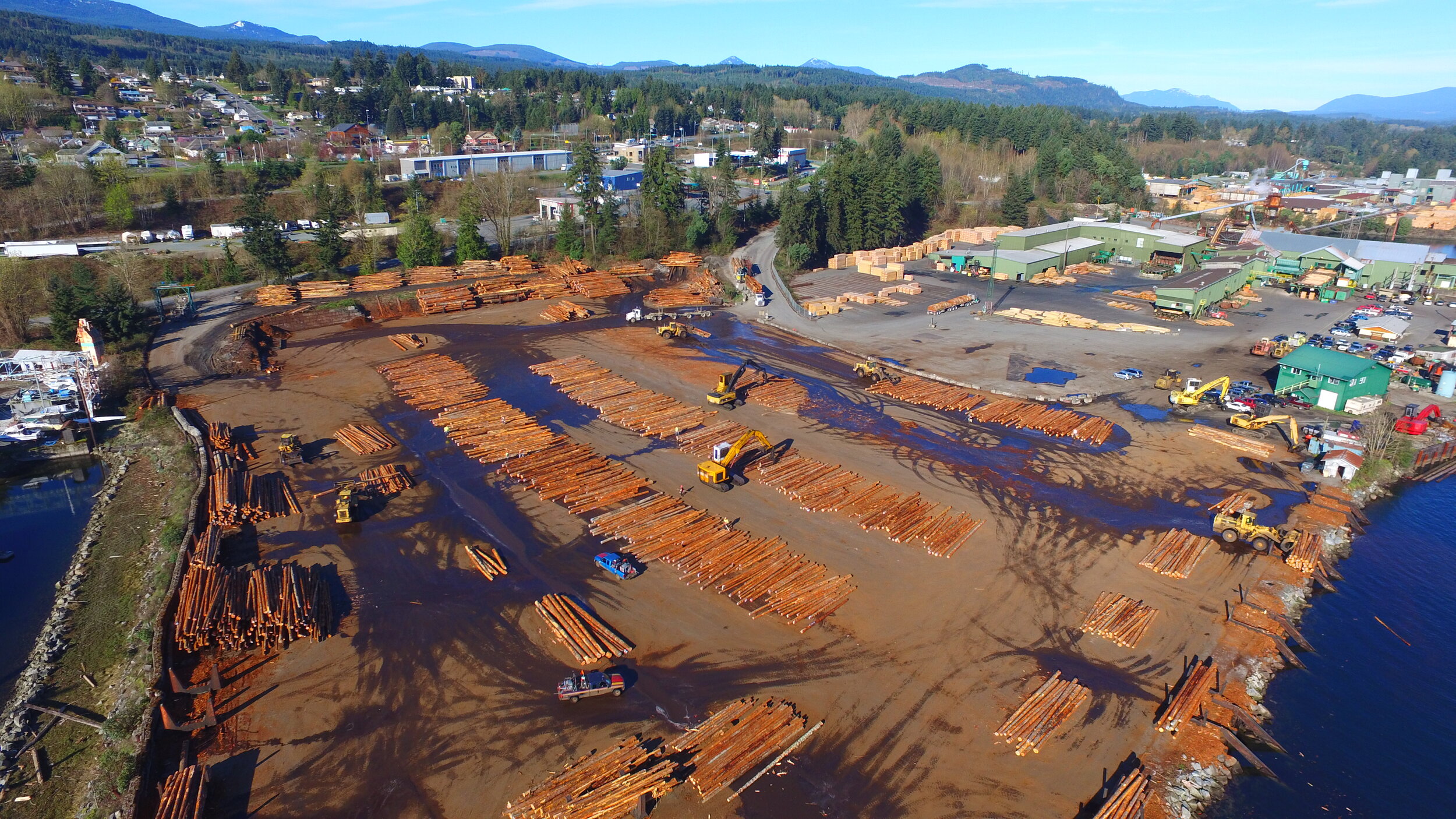
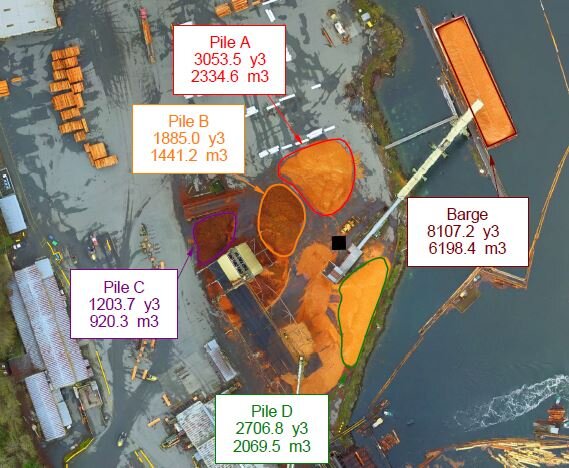
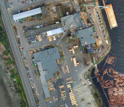
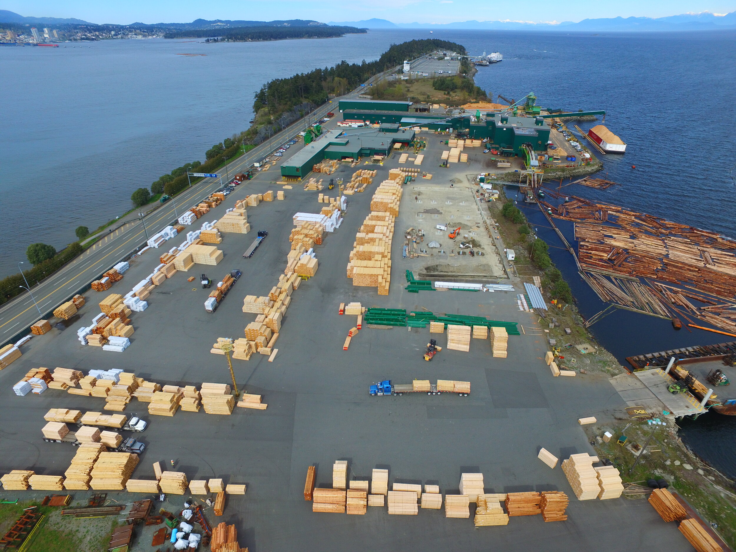
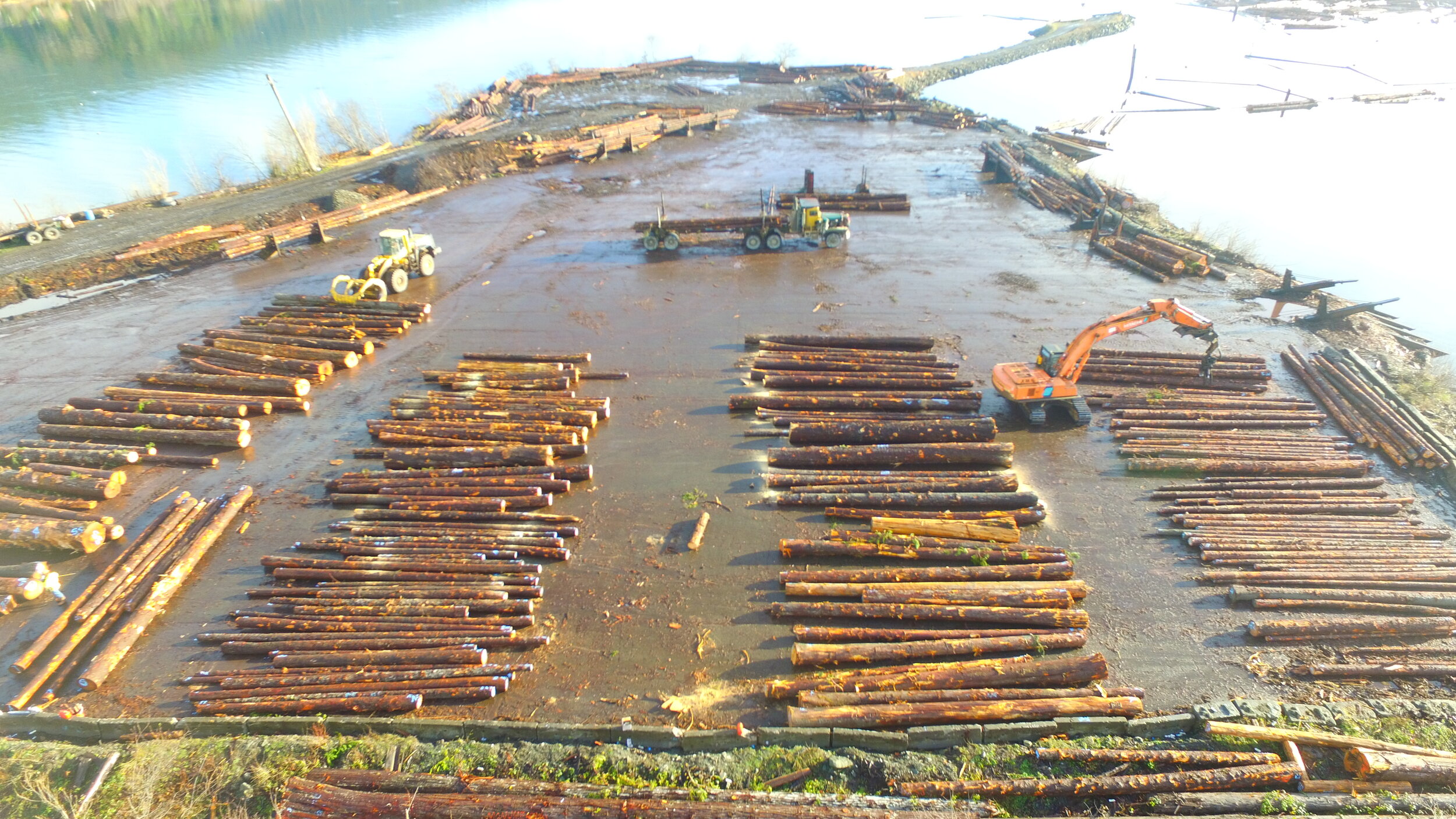
Sawmill Mapping – WFP Manufacturing
Western Forest Products operates six mills on Vancouver Island. To improve the logistics and safety of the sites, they required overhead imagery and accurate maps. SuavAir flew all six sites and provided data that helped safety managers identify areas of improvement for worker safety. High resolution maps were used as a planning tool to improve work flows for higher production.
“The feedback from the managers has been very good as to the quality of the product. It has helped with traffic flow productivity and job safety breakdowns.”
–Mark Haupt, Health and Safety Officer
Eel Grass Habitat Mapping – Campbell River Salmon Foundation
We produced high-resolution maps of the Campbell River estuary for the Salmon Foundation to monitor eel grass habitat and other environmental features. By mapping these eelgrass beds, biologists will be able to monitor high value habitat within the estuary over time.
As the estuary has several helicopter and seaplane companies, we had to coordinate and communicate in advance and during the operation. This allowed us to safely map the 125 hectare project while ensuring the UAV did not impact their manned aviation operations.

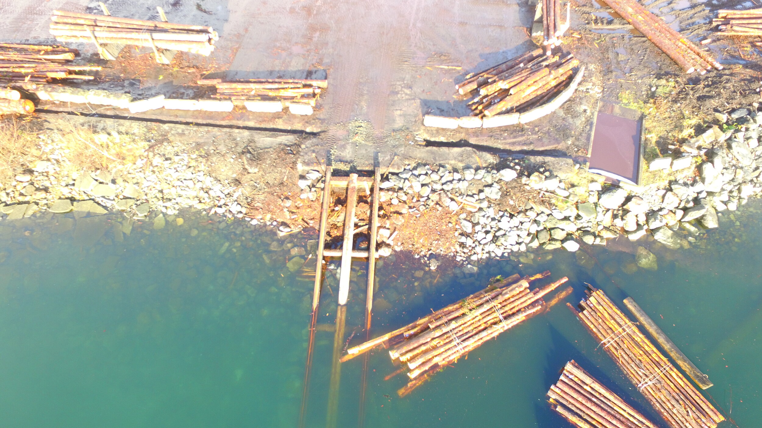
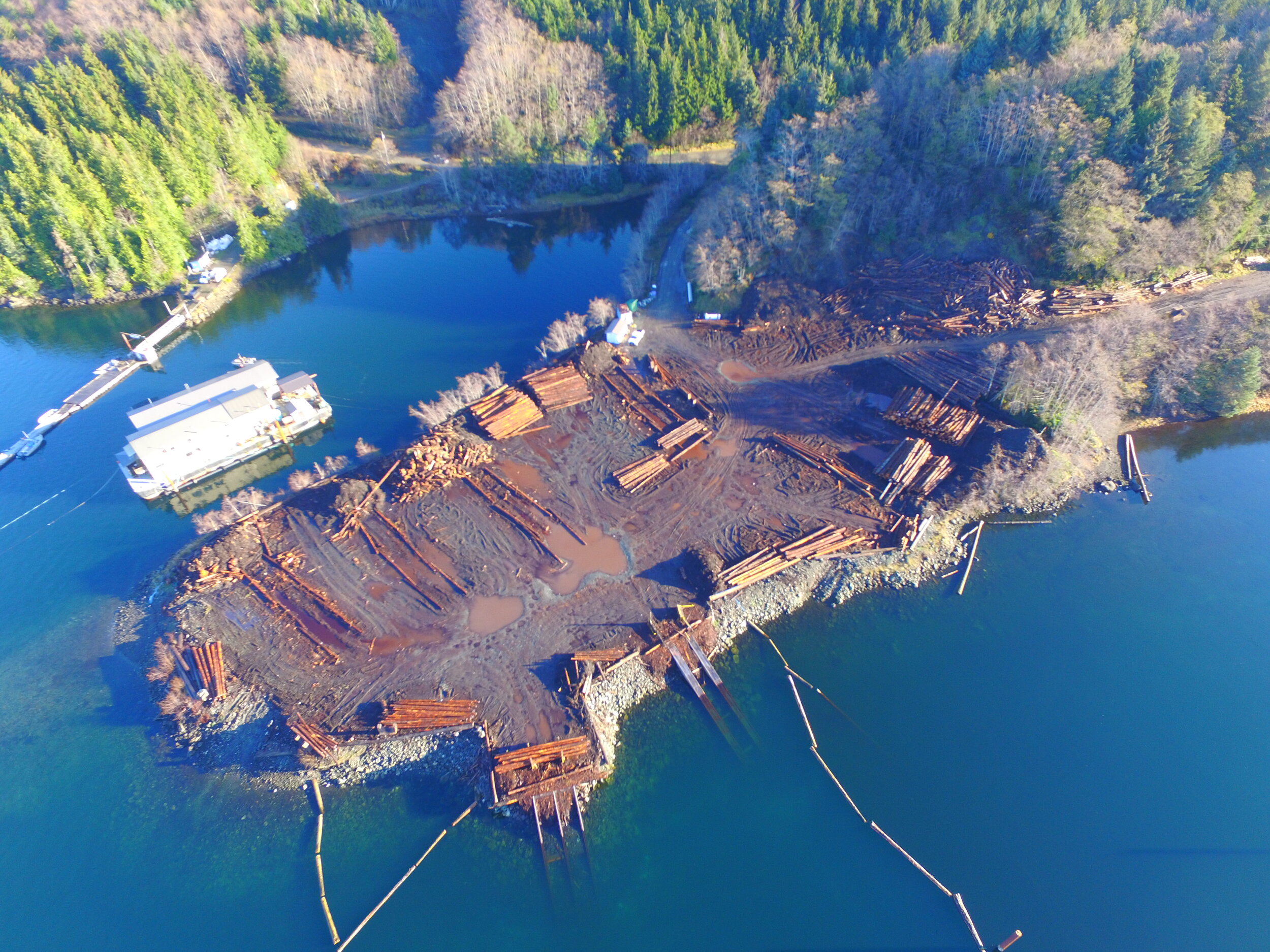
Dry Land Sort Environmental Planning – Taan Forest
Ongoing maintenance and monitoring of dry land sorts is important to mitigate environmental impacts. Using a combination of UAVs and ground truthing, we were able to assess 5 dry land sorts for any environmental compliance issues and create high resolution maps with recommendations to resolve any problems. The UAV imagery was also helpful in mapping the adjacent woody debris landfills and determining the remaining volume capacity.

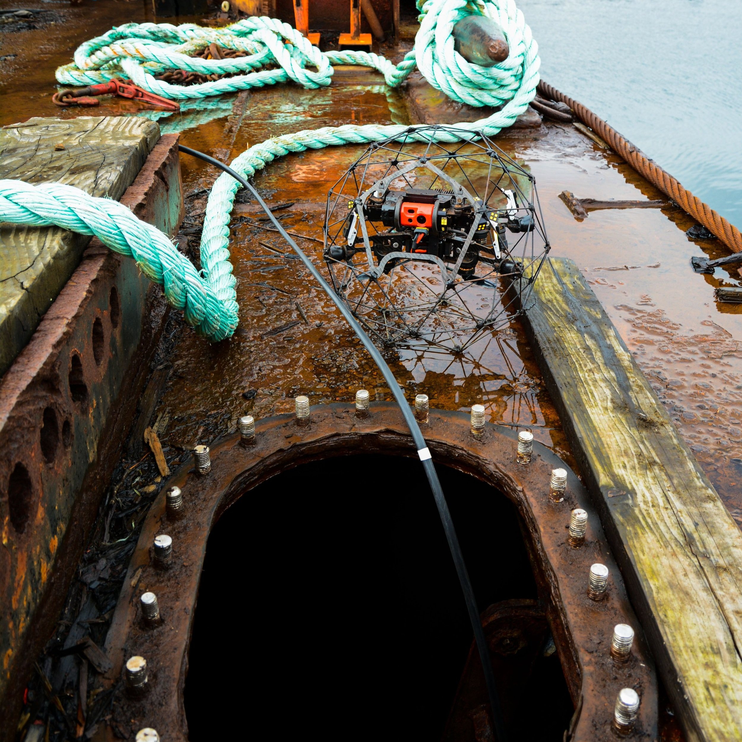
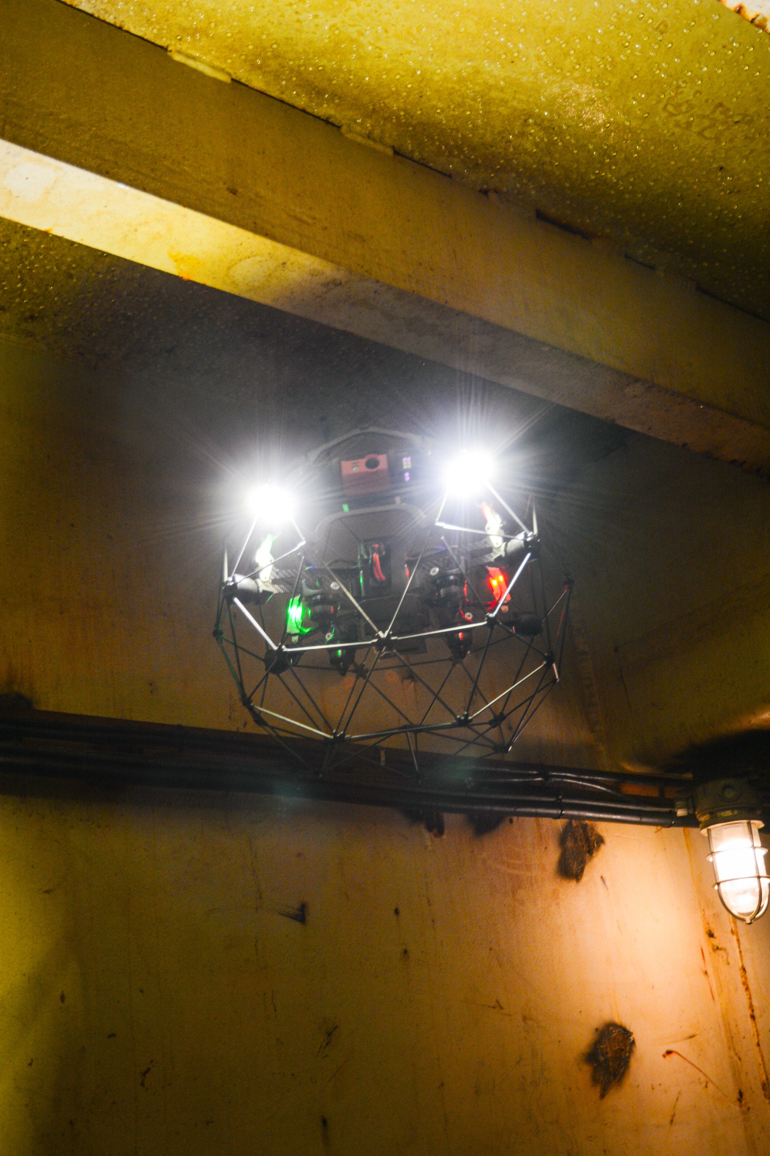
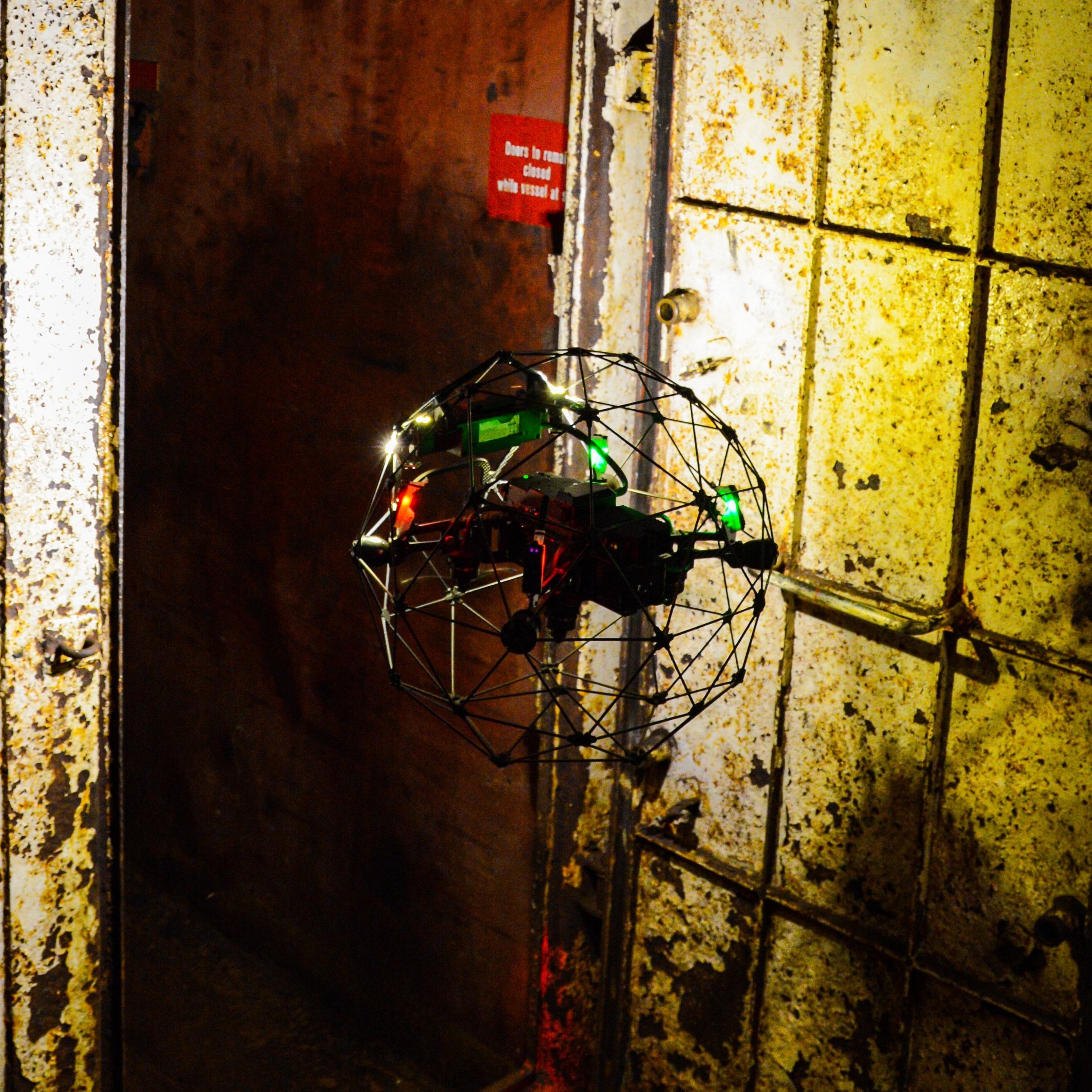
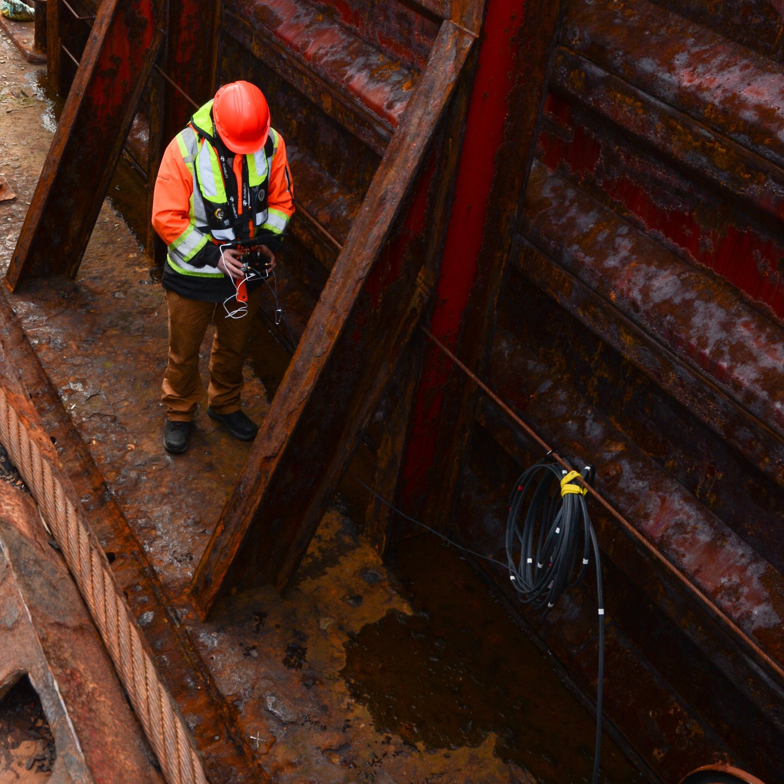
Barge Hold Confined Space Inspection - AMIX
Barge inspections are critical in order to ensure that the vessels are in good working order and to determine what repairs are needed. Conducting these inspections in confined spaces are time consuming and hazardous. We were able to conduct inspections on the barge holds, identifying cracks, deformations and significant rust for the client in an efficient and safe manner.