
Environmental Monitoring
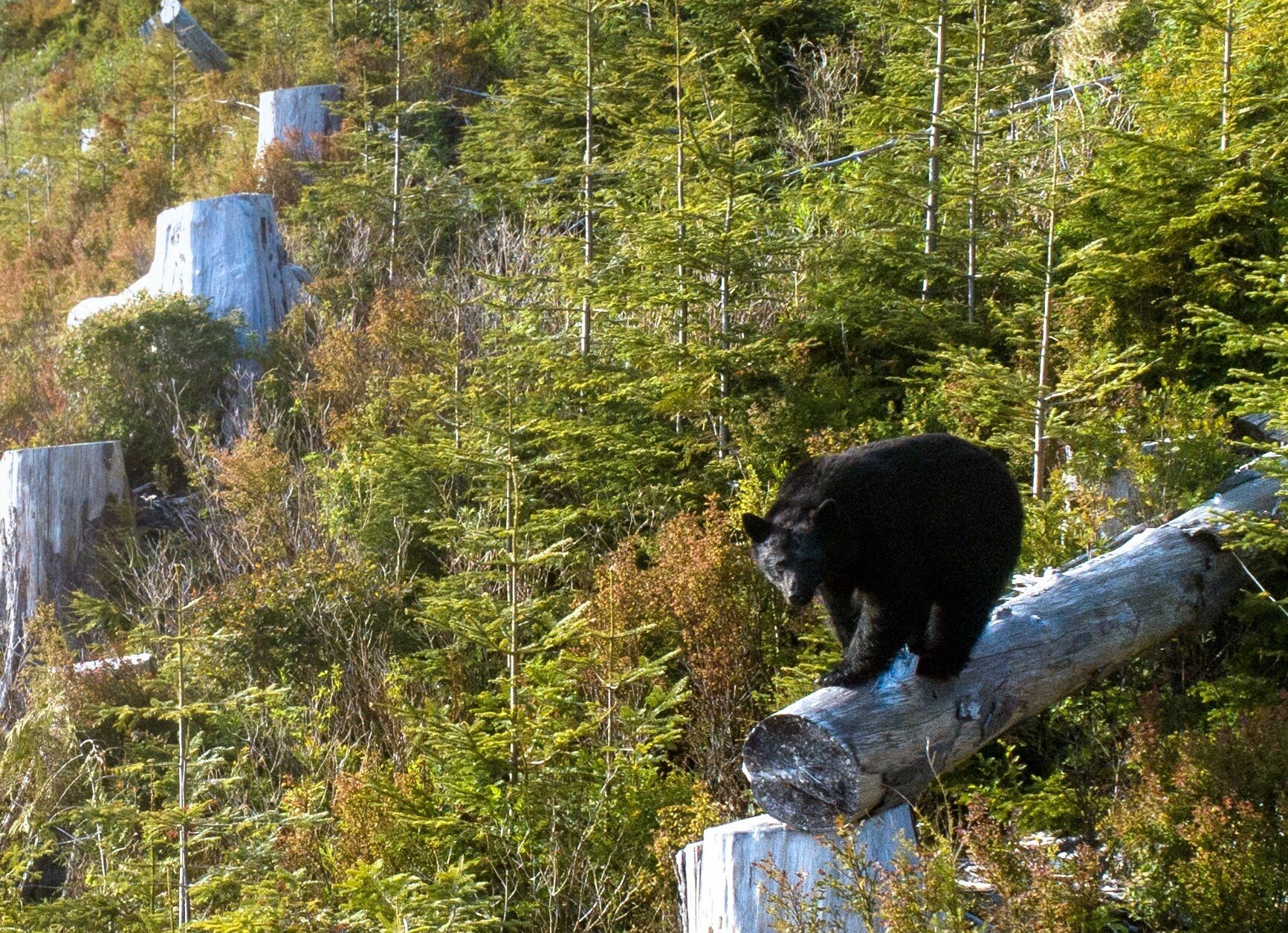
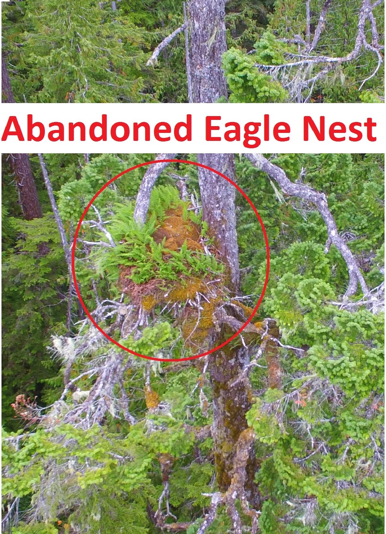
Using drones, we have carried out a wide variety of environmental projects, including sedimentation tracking in watersheds, raptor nest identification, wildlife identification, habitat restoration, estuary monitoring, and many more. There are so many environmental applications where UAV imagery can provide meaningful documentation and data. The imagery can also act as proof that a project was completed or that an environmental condition was present at that time. All imagery is spatially referenced and time stamped.
Invasive Species Mapping – Parks Canada
The Gulf Island National Park is home to several rare species of plants. Unfortunately, they have been encroached on by invasive plants. As part of Parks Canada’s mandate to remove the invasive species, we mapped the area in extremely high resolution (1cm) to help them in their environmental management strategy. Also acquired oblique angle imagery for their website and social media marketing.

Invasive Scotch Broom growing on a Parks Canada island near Victoria, BC
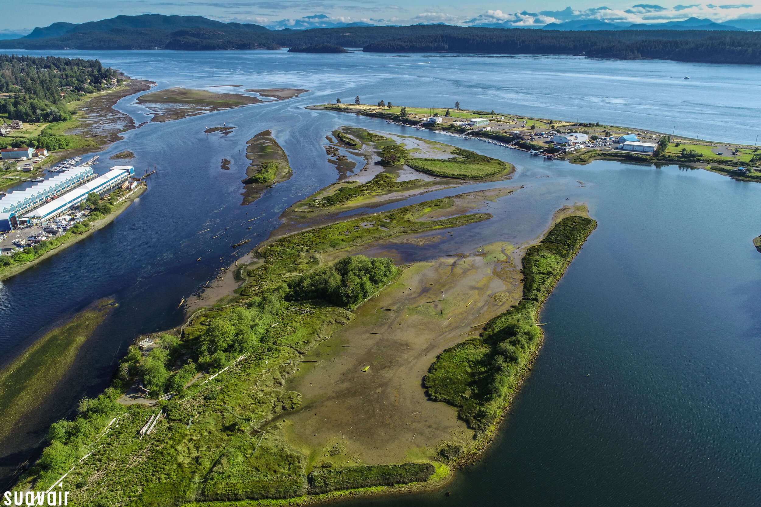
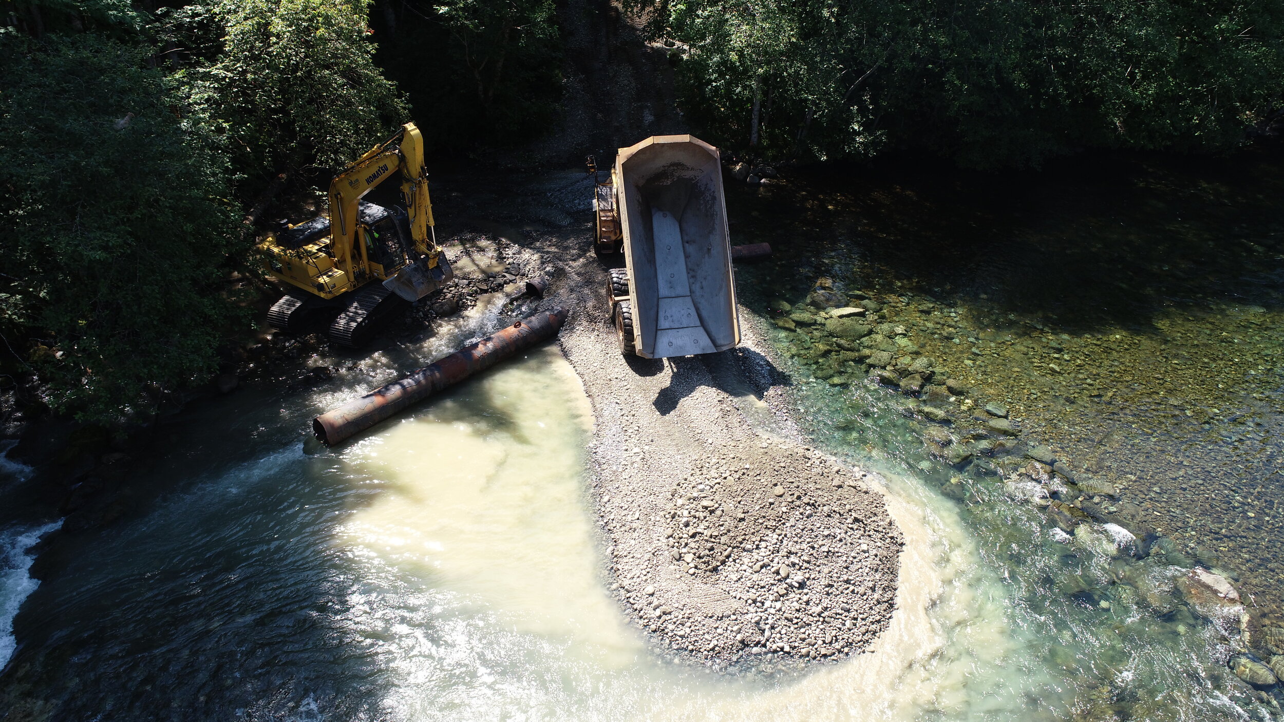
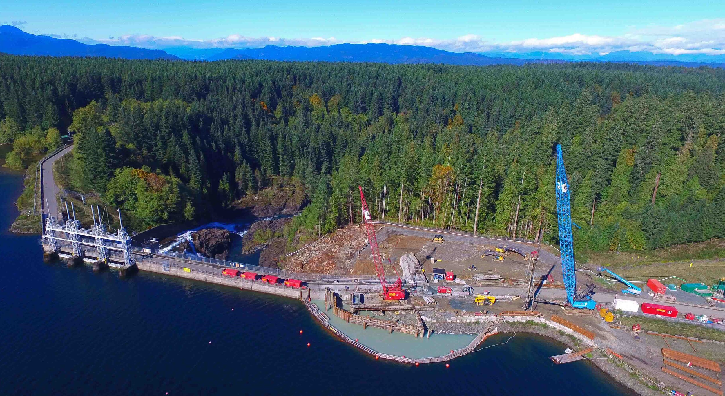
Gravel Spawning Monitoring – BC Hydro & Department of Fisheries and Oceans (DFO)
In the summer of 2016, 1,800 m3 of gravel was introduced to the Campbell River in historical breeding territory for Chinook and Coho salmon. However, due to extremely heavy rainfall and the resulting highflows, much of the gravel was displaced downstream. SuavAir was hired to document the entire process, from before the gravel was placed (July 2016) all the way through to the gravel being displaced (December 2016). Using a polar lens to penetrate the water surface, we were able to survey and map the site for our client’s to determine the best management strategy going forward.

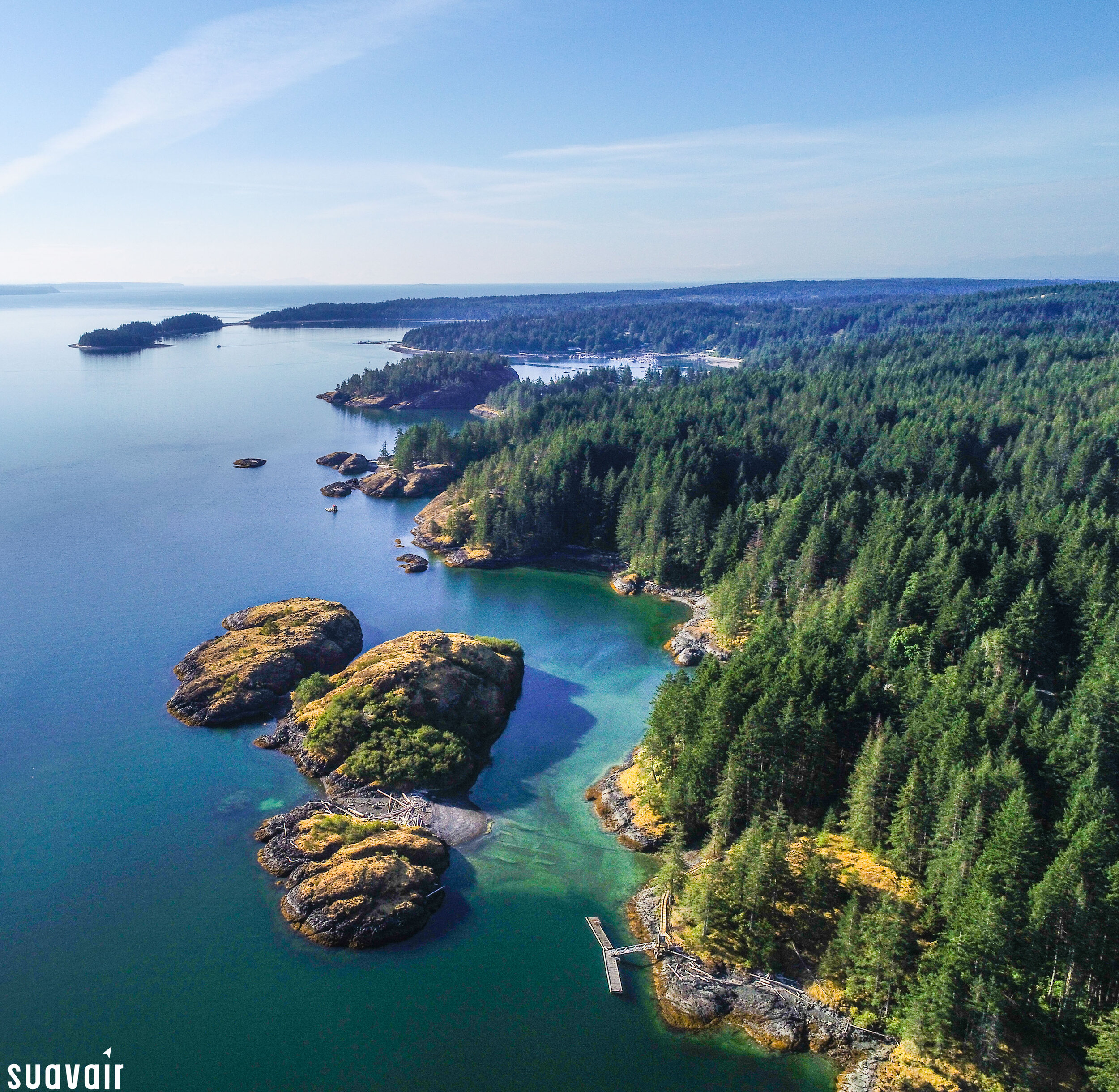
Seat Otter Population Survey - Kyuquot (CKFN)
Summer of 2021, SuavAir worked with CKFN and their Environmental Office to conduct a population survey of Sea Otters within their traditional territory. The RPAS was used to collect videos and images of individuals and large rafts to get an accurate count of the population. The drone was able to access areas that a boat could not.
