
Post Harvest Inspections
We produce high resolution, georeferenced orthographic maps for post harvest inspections. Retention can be mapped to 0.01ha, slash piles counted, and road deactivation confirmed.
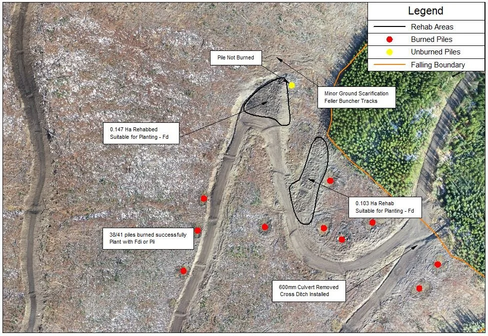
Documenting the post-harvest after deactivation - counting burned piles, measuring rehabbed roads, and checking road deactivation
Accurate Mapping
Harvest boundaries can differ from boundaries in the cutting permit application. We can accurately map these deviations for waste and residue surveys, block and retention boundaries for the NAR, site prep, planting and survey maps.

Mapping retention left along streams, as well as pits created while road building
High Resolution Documentation
Over time things change: trees blow down, wildfires burn, insects invade. Our high resolution imagery documents the state of the block when the last machine has left. If there are disputes over whether trees were logged by man or nature, this imagery is your due diligence.
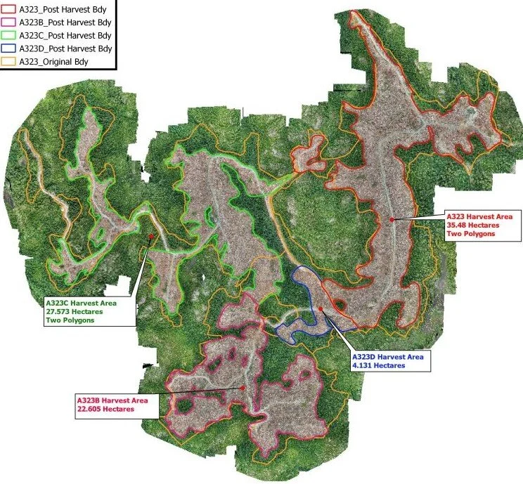
Final harvest boundaries of a private land block mapped and shapefiles created to determine final area
Increased Efficiency = Lower Costs
More productive than a ground inspection and less expensive than airplane photos, SuavAir will complete these inspections safely while minimizing costs to the client.
Documented Maps = long term proof
The high-resolution maps are documentation of the block condition at that given time. The imagery serves as proof that the company completed their due diligence and can be used as proof in the event of an audit.